Sponsored
Garmin GPSMAP 66sr Handheld with Sensors and TOPO Maps - Black
Create or manage registry
At a glance
Sponsored
About this item
Highlights
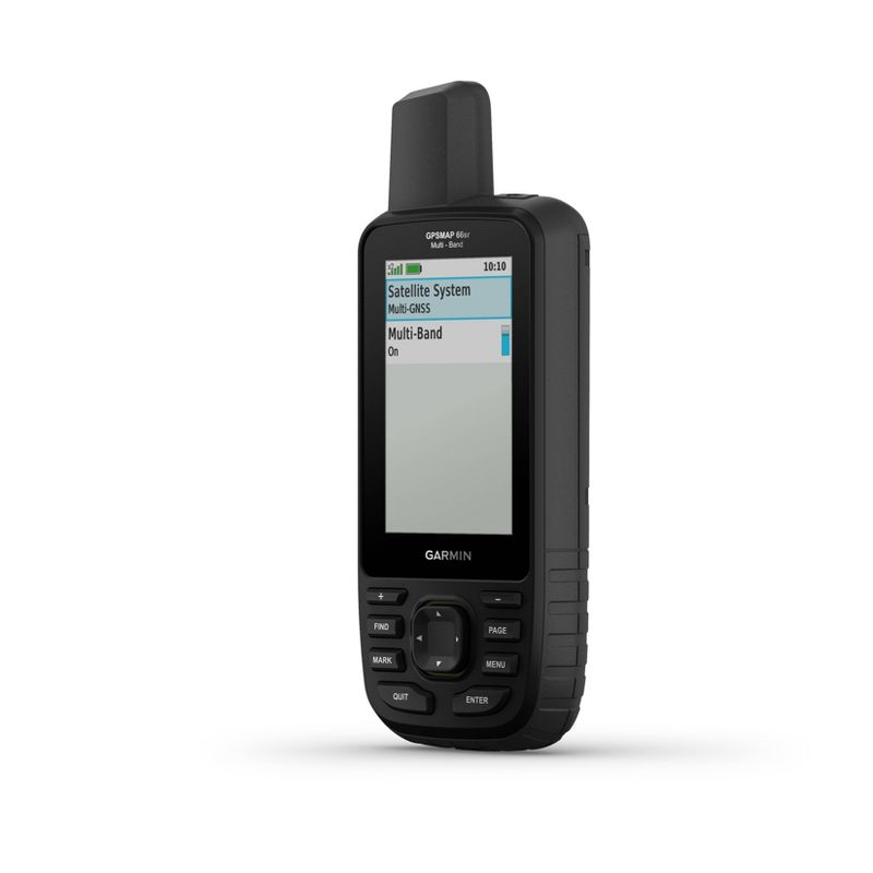
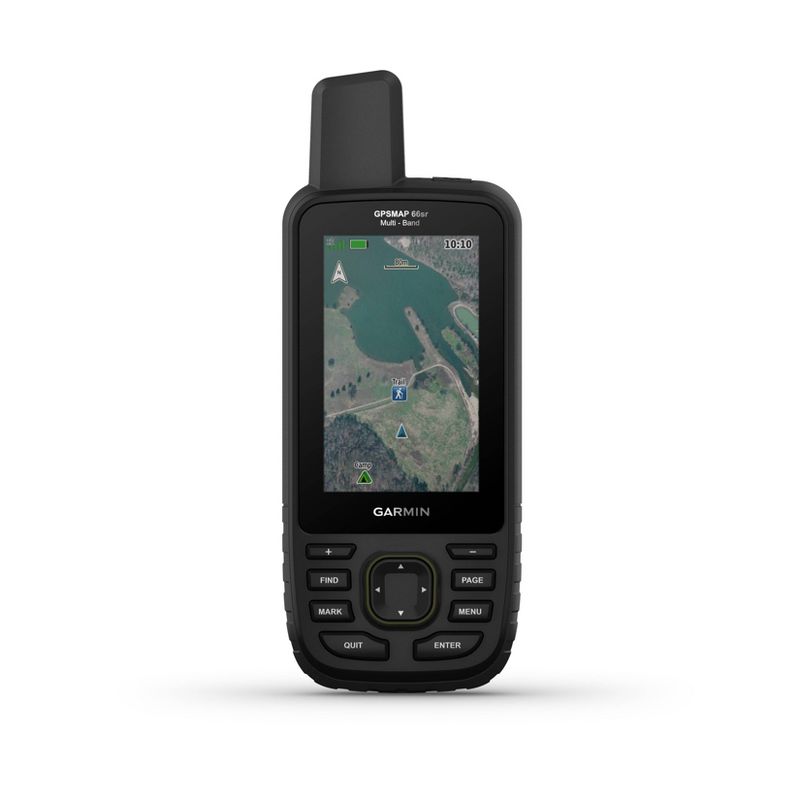
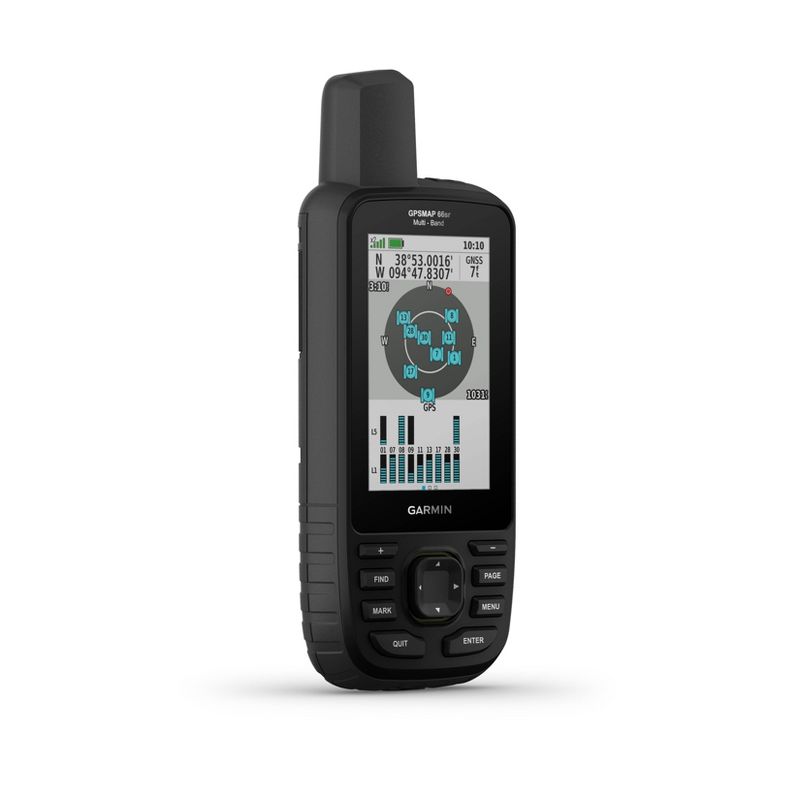
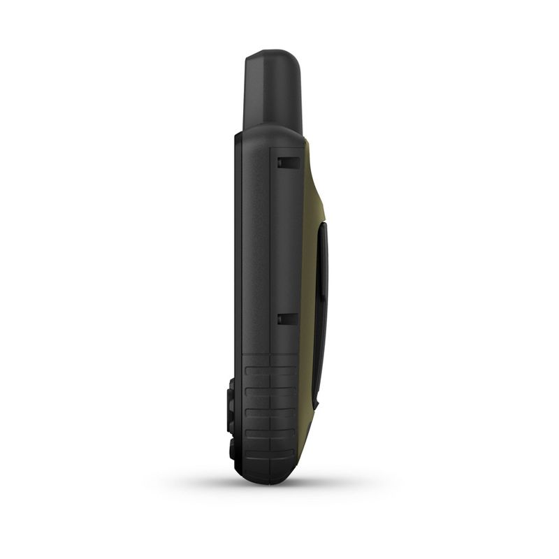
- Large 3” sunlight-readable color display for easy viewing
- Expanded global navigation satellite systems (GNSS) and multi-band technology allow you to get optimal accuracy in challenging locations, including steep country, urban canyons and forests with dense trees
- Powered by internal Li-ion rechargeable battery, with up to 36 hours battery life in Standard Mode and up to 450 hours in Expedition Mode.
- Access to BirdsEye Satellite Imagery with direct downloads and no annual subscription plus routable TopoActive mapping and federal public land map (U.S. only)
- Go-anywhere navigation with 3-axis compass and barometric altimeter
- Expanded wireless connectivity supports Active Weather for up-to-date forecasts and animated weather radar and Geocaching Live for mobile syncing and updates Compatible with the Garmin Explore™ website and app (compatible smartphone required) to help you manage tracks, routes and waypoints and review statistics from the field
Description
Find your way in this big, wide world with GPSMAP® 66sr. This premium, rugged handheld offers multi-band technology and expanded GNSS support for optimal accuracy in steep country, urban canyons and forests with dense trees. It has a 3” color display, and it’s packed with ABC (altimeter, barometer and compass) sensors, routable TopoActive mapping and subscription-free BirdsEye Satellite Imagery with unlimited direct-to-device access via Wi-Fi® wireless networking. Wireless connectivity through BLUETOOTH® and ANT+® technologies provides Active Weather and Geocaching Live updates, and compatibility with the Garmin Explore™ app (compatible smartphone required) gives you offline access to cloud-based route planning.
Additional product information and recommendations
Sponsored
Similar items
Loading, please wait...
Your views
Loading, please wait...
More to consider
Loading, please wait...
Featured products
Loading, please wait...