Target New ArrivalsHalloweenClothing, Shoes & AccessoriesHome & DecorKitchen & DiningPatio, Lawn & GardenGroceryHousehold EssentialsBabyBeautyTarget Beauty StudioPersonal CareSports & OutdoorsPetsHealthWellnessSchool & Office SuppliesToys & GamesElectronics & TechVideo GamesBooks, Music & MoviesParty SuppliesGift IdeasGift CardsShop by CommunityTarget OpticalDealsClearanceNew ArrivalsBack to SchoolCollegeTop DealsTarget Circle DealsWeekly AdShop Order PickupShop Same Day DeliveryRegistryRedCardTarget CircleFind Stores
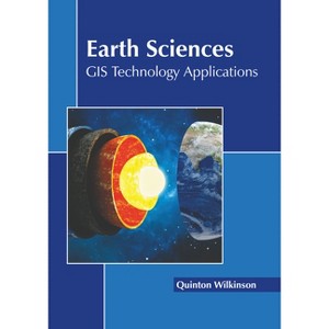
Earth Sciences: GIS Technology Applications - by  Quinton Wilkinson (Hardcover) - 1 of 1

Earth Sciences: GIS Technology Applications - by Quinton Wilkinson (Hardcover)

$114.99Save $40.01 (26% off)

In Stock

Free & easy returns
Free & easy returns
Return this item by mail or in store within 90 days for a full refund.
Eligible for registries and wish lists
Save 5% every day
With Target Circle™ Card (restrictions apply)

About this item

Highlights

  • Earth sciences refers to the branch of science that deals with the physical, chemical and biological complex constitutions and synergistic linkages of Earth's four spheres, namely, biosphere, hydrosphere, atmosphere and geosphere.
  • Author(s): Quinton Wilkinson
  • 240 Pages
  • Technology & Engineering, Remote Sensing & Geographic Information Systems

Description


About the Book


Earth sciences refers to the branch of science that deals with the physical, chemical and biological complex constitutions and synergistic linkages of Earth's four spheres, namely, biosphere, hydrosphere, atmosphere and geosphere. A geographic information system (GIS) is a type of computer system that captures, stores, verifies and presents information about different locations and conditions that exist on the surface of the Earth. It facilitates geospatial data analysis, scientific communication, data gathering, collaborative research and visualization. GIS can display a wide range of data on a single map, including plants, streets and buildings. It allows the evaluation and comprehension of relationships and patterns easily. GIS is essential in the field of Earth sciences since it offers an effective way of viewing the world, and serves as a tool for tackling challenging issues such as identifying the drought area, managing oil spills and disaster management. This book elucidates the concepts and innovative models around prospective developments with respect to the applications of geographic information system in Earth sciences. Scientists and students actively engaged in the field of Earth sciences will find it full of crucial and unexplored concepts.


Book Synopsis


Earth sciences refers to the branch of science that deals with the physical, chemical and biological complex constitutions and synergistic linkages of Earth's four spheres, namely, biosphere, hydrosphere, atmosphere and geosphere. A geographic information system (GIS) is a type of computer system that captures, stores, verifies and presents information about different locations and conditions that exist on the surface of the Earth. It facilitates geospatial data analysis, scientific communication, data gathering, collaborative research and visualization. GIS can display a wide range of data on a single map, including plants, streets and buildings. It allows the evaluation and comprehension of relationships and patterns easily. GIS is essential in the field of Earth sciences since it offers an effective way of viewing the world, and serves as a tool for tackling challenging issues such as identifying the drought area, managing oil spills and disaster management. This book elucidates the concepts and innovative models around prospective developments with respect to the applications of geographic information system in Earth sciences. Scientists and students actively engaged in the field of Earth sciences will find it full of crucial and unexplored concepts.
Dimensions (Overall): 11.0 Inches (H) x 8.5 Inches (W) x .56 Inches (D)
Weight: 1.87 Pounds
Suggested Age: 22 Years and Up
Number of Pages: 240
Genre: Technology & Engineering
Sub-Genre: Remote Sensing & Geographic Information Systems
Publisher: Callisto Reference
Format: Hardcover
Author: Quinton Wilkinson
Language: English
Street Date: September 26, 2023
TCIN: 1011992066
UPC: 9781641168083
Item Number (DPCI): 247-26-7998
Origin: Made in the USA or Imported
If the item details aren’t accurate or complete, we want to know about it.

Shipping details

Estimated ship dimensions: 0.56 inches length x 8.5 inches width x 11 inches height
Estimated ship weight: 1.87 pounds
We regret that this item cannot be shipped to PO Boxes.
This item cannot be shipped to the following locations: American Samoa (see also separate entry under AS), Guam (see also separate entry under GU), Northern Mariana Islands, Puerto Rico (see also separate entry under PR), United States Minor Outlying Islands, Virgin Islands, U.S., APO/FPO, Alaska, Hawaii

Return details

This item can be returned to any Target store or Target.com.
This item must be returned within 90 days of the date it was purchased in store, delivered to the guest, delivered by a Shipt shopper, or picked up by the guest.
See the return policy for complete information.

Additional product information and recommendations

Discover more options

Skip to next section

Best-selling Adult Non-Fiction Books

Skip to next section

Get top deals, latest trends, and more.