About this item
Highlights
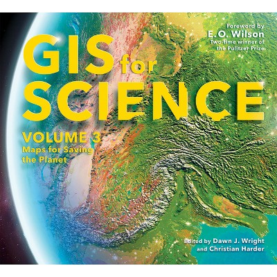
- GIS for Science presents a collection of real-world stories about modern science and a cadre of scientists who use mapping and spatial analytics to expand their understanding of the world.
- Author(s): Dawn J Wright & Christian Harder
- 252 Pages
- Technology, Remote Sensing & Geographic Information Systems
- Series Name: GIS for Science
Description
About the Book
See how scientists working on the world's most pressing problems apply geographic information systems--GIS.
Book Synopsis
GIS for Science presents a collection of real-world stories about modern science and a cadre of scientists who use mapping and spatial analytics to expand their understanding of the world.
The accounts in this book are written for a broad audience including professional scientists, the swelling ranks of citizen scientists, and people generally interested in science and geography. Scientific data are brought to life with GIS technology to study a range of issues relevant to the functioning of planet Earth in a natural sense as well as the impacts of human activity. In a race against the clock, the scientists profiled in this volume are using remote sensing, web maps within a geospatial cloud, Esri StoryMaps, and spatial analysis to document and solve an array of issues with a geographic dimension, ranging from climate change, natural disasters, and loss of biodiversity, to homelessness, loss of green infrastructure, and resource shortages.
These stories present geospatial ideas and inspiration that readers can apply across many disciplines, making this volume relevant to a diverse scientific audience.
See how scientists working on the world's most pressing problems apply geographic information systems--GIS.
From the Back Cover
GIS for Science brings to life a collection of real-world examples of scientists using geographic information systems (GIS) to expand our understanding of the world. They are part of a global effort to find ways to sustain a livable environment for all life on the planet. At Esri, we call this The Science of Where(R), a concept that merges our impulse to dream, discover, and understand with the rigor and discipline of the scientific process and the foundation of geography. As such, GIS provides a framework for applying science to almost every human endeavor as we aspire to transform the world through mapping and analytics.
The stories in this book are written for professional scientists, the swelling ranks of citizen scientists, and anyone interested in science and geography. The contributors represent a cross section of scientists who employ data gathered from satellites, aircraft, ships, drones, and myriad other remote-sensing technologies. This data is brought to life with GIS to study a range of issues relevant to our understanding of planet Earth and beyond. Scientists are documenting an array of geographically oriented issues ranging from climate change, natural disasters, and loss of biodiversity to political strife, disease outbreaks, and resource shortages.
The examples in this collection show how ArcGIS(R) software and the ArcGIS(R) Online cloud-based system work as a comprehensive geospatial platform to support research, collaboration, spatial analysis, and communication across many settings and communities. In these chapters, you'll learn about research on the effects of climate change on glaciers, advances in drone-based archaeological methods, the creation of a data-derived map of the world's ecosystems, efforts to preserve iconic avian habitats, and much more. These stories present GIS ideas and inspiration that users can apply across many disciplines, making this volume relevant to diverse scientific audiences.
Review Quotes
"Advances in remote sensing and geographic information systems allow us to observe, monitor, and understand the planet in unprecedented levels of detail. Data that once had to be collected through painstaking and laborious fieldwork are now available instantly, online, anywhere. This beautifully illustrated and inspiring book brings home the power of today's technology with unique effectiveness, telling and illustrating stories from the earth sciences in novel and powerful ways. A must-have book for anyone concerned about the planet's future."
--Mike Goodchild, Distinguished Emeritus Professor and Research Professor of Geography, UC Santa Barbara
-- "Mike Goodchild""As an ecologist, GIS provides the platform that allows us to generate a holistic perspective of the natural world. This spatial understanding is so critical for us to be able to understand and address the global threats of biodiversity loss and climate change. Given the relevance of this geospatial perspective for all aspects of society, I hope this beautiful book will inspire a wide range of people to embrace the 'Science of Where.' "
--Thomas Crowther, Director at Global Forest Biodiversity Initiative
-- "Thomas Crowther""This book is beautiful as well as illuminating, and it dramatizes the ways in which the new science of geospatial information is enriching and empowering all other scientific disciplines."
--James Fallows, Staff Writer at The Atlantic and former Chief Speechwriter for President Jimmy Carter
-- "James Fallows"


